

9-1 Two Volunteer Activities Focused on the “Unknown”
The Great Hanshin-Awaji Earthquake on January 17, 1995, claimed the lives of more than 6,400 people. The Lehman Shock in September 2008 caused chaos in the global economy that went beyond market control, and the Japanese economy also suffered immense damage as a result.Then, on March 11, 2011, the Great East Japan Earthquake struck. The massive tsunami and aftershocks claimed the lives of more than 18,000 people (as announced by the Tokyo Metropolitan Police Department’s Emergency Disaster Security Headquarters in August 2014) and triggered the accident at the Fukushima Daiichi Nuclear Power Plant.Furthermore, we must remain vigilant regarding the impacts of climate change caused by global warming.
“The unknown”—which can bring about negative consequences due to natural disasters or political and economic trends—is constantly emerging. However, addressing “the unknown” is essential, and even when dealing with such issues is difficult, the accumulation of persistent efforts toward that end is indispensable. Here, we introduce two examples of the steady, volunteer-driven activities undertaken by young members of the Nikken Group as they tackle “the unknown.”
"Escape Map," created by a volunteer group of Nikken Sekkei employees
In the areas where evacuation shelters and roads had been destroyed immediately after the disaster, volunteers from the Disaster Recovery Volunteer Club listened to the concerns of local residents who feared another tsunami and helped them plan and map out evacuation routes. This is commonly known as the “Escape Map.”On the map, we overlaid historical tsunami data to indicate areas at risk of flooding using varying shades of color. At the same time, we color-coded the evacuation routes to safe areas, showing the estimated time it would take for elderly residents to walk along them. We call these maps, which visualize the time required for evacuation, “escape maps.”
The “Escape Map” was created collaboratively through workshops involving local residents and members of the volunteer group.The completed “Evacuation Map” serves not only as a reference for formulating evacuation plans but also as a base map for considering where and how to take action to improve safety. Furthermore, it enables residents to take the lead in proposing safe community development initiatives tailored to the specific characteristics and realities of their area.
While “Evacuation Maps” have been created in various districts of Miyagi and Iwate Prefectures, making them available online has made it possible to compile and view a large number of examples. It is hoped that this approach will lead to further improvements and the generation of new proposals.It is also being tested as a tool for planning evacuation routes and urban development in areas such as Tokyo’s waterfront districts. By enabling urban development based on a new consensus-building process, the “Escape Map” was selected—together with local residents—for the Good Design Best 100 in the 2012 Good Design Awards.It also won the Grand Prize in the “Code for Resilience” collaborative project competition, established by the World Bank’s Global Facility for Disaster Risk Reduction to build disaster-resilient societies.
-
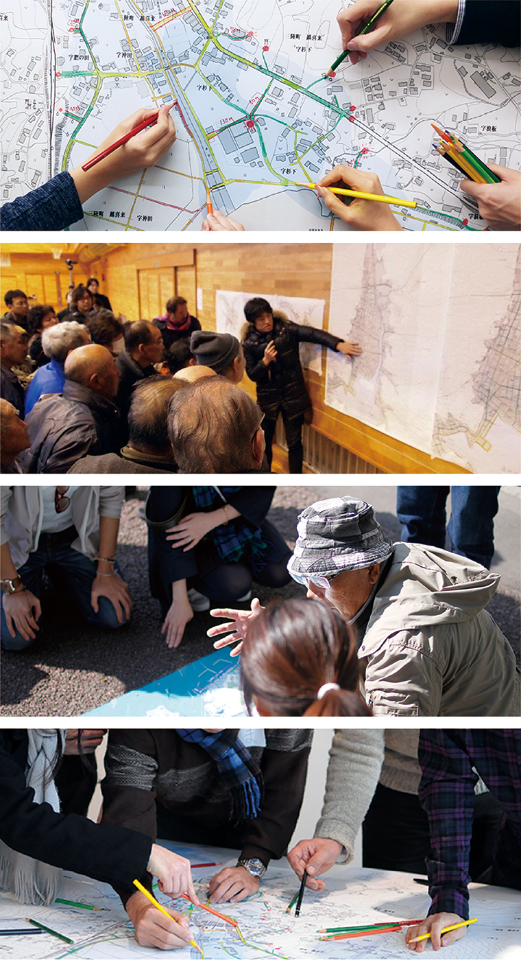 9-1 “Escape Map” Activity
-
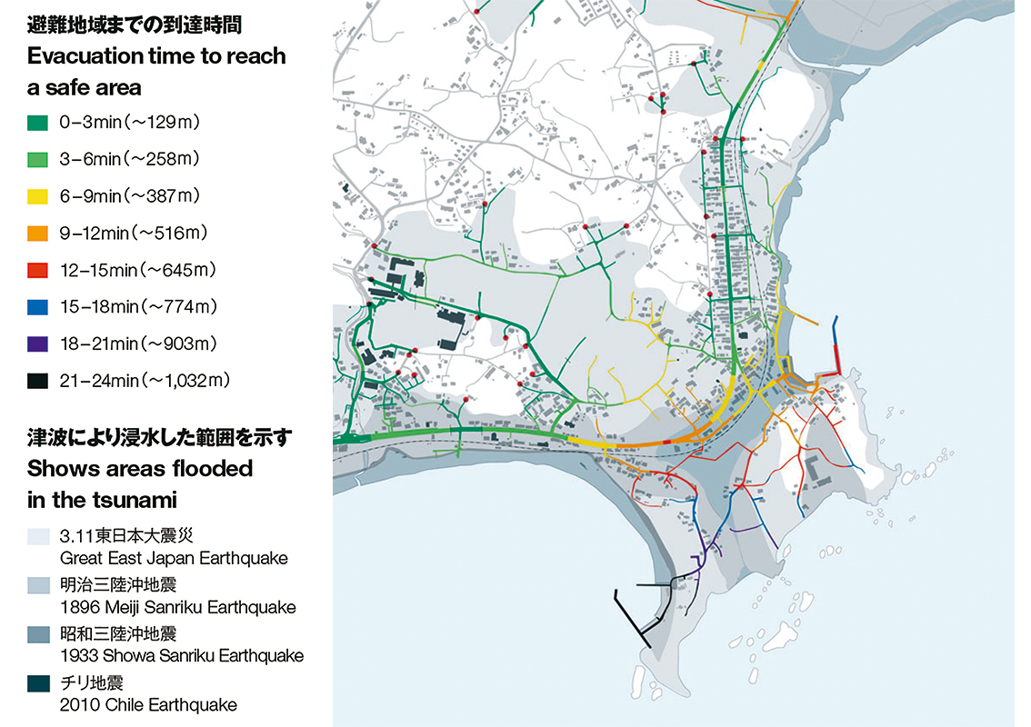 9-2 The varying shades of gray indicate the inundation areas for the Meiji Sanriku Offshore Earthquake, the Showa Sanriku Offshore Earthquake, the Chile Earthquake, and the Great East Japan Earthquake. Note that the lightest and largest gray area represents the inundation area from the Great East Japan Earthquake. The colors on the roads indicate the time and distance required for evacuation.
-
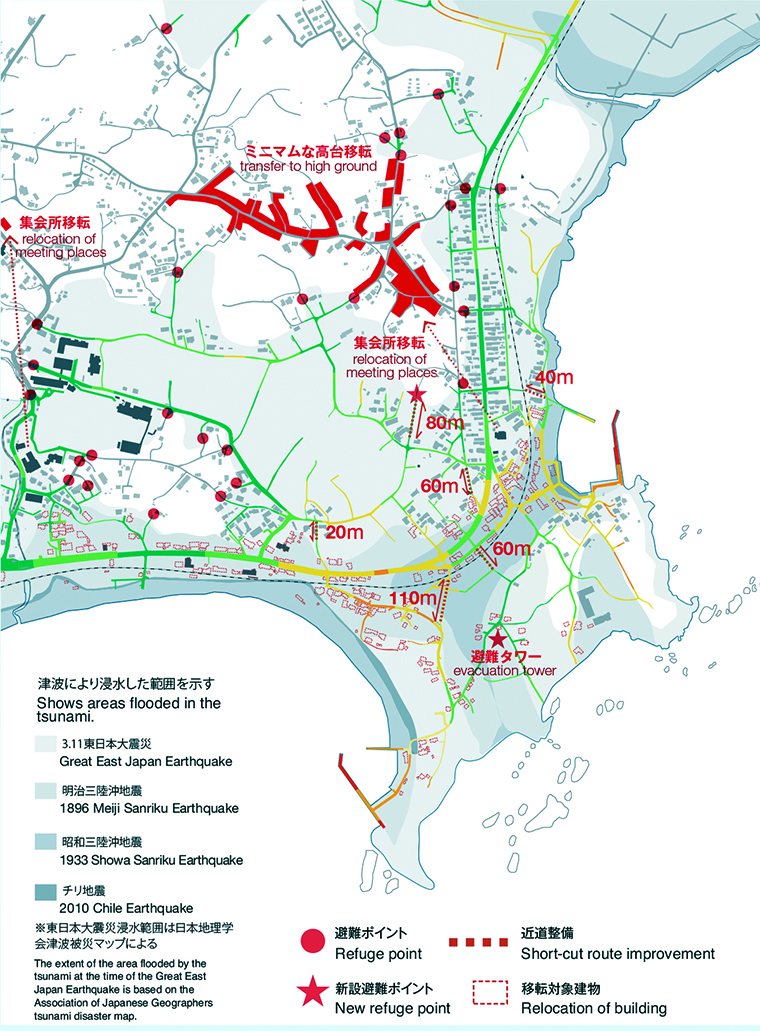 9-3: Preliminary Reconstruction Plan Guided by the “Evacuation Map”
This plan combines the development of shortcut routes, the construction of evacuation towers, minimal relocation to higher ground, and the reallocation of evacuation shelters. By examining these measures from the perspectives of “survival,” “livelihood,” and “daily life” using the “Escape Map” and selecting cost-effective measures, we can propose a reconstruction plan best suited to the target area.
Together with the children and villagers of “Mati Zhai Hope Primary School” in Yunnan Province, China
Since Ma Tiejia is a village located in a mountainous region with a harsh climate, the majority of the working-age population has migrated to find work elsewhere, leaving many children to live in a boarding school. Furthermore, because there is little flat land where people can gather, the project aimed to make this elementary school a valuable public space for the village.
Several ethnic minorities live in this village, and their unique cultures—including their languages, traditional clothing, and dances—are still very much alive today. Therefore, rather than building a standardized school, the goal was to create a school that respects ethnic minority cultures based on the philosophy of “One School, One Art; One Village, One Craft.”
Furthermore, the volunteers proposed that the entire process—from conception to construction—be treated as a “crafting” endeavor that brings together the village’s natural resources and local skills. This proposal, along with the principles of “village-building” and “people-building,” was adopted as the fundamental concept for building the school.This volunteer effort proceeded through enthusiastic, in-depth discussions—extending even to the very nature of the school—in collaboration with local government officials responsible for education and the teachers.
-
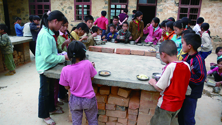 9-4 Children Eating Lunch at a Ping-Pong Table
-
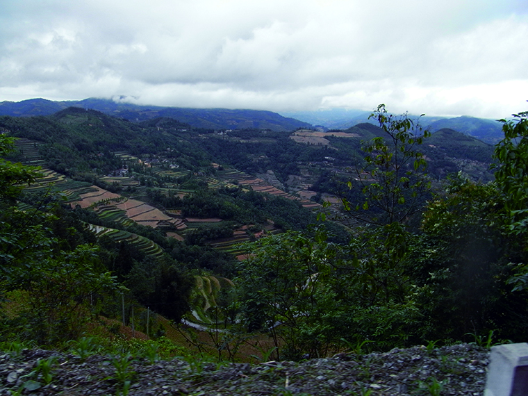 9-5 Mountainous Region Covered with Terraced Rice Fields
-
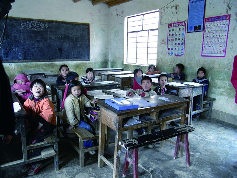 9-6: A Class in Progress with Groups of Four
-
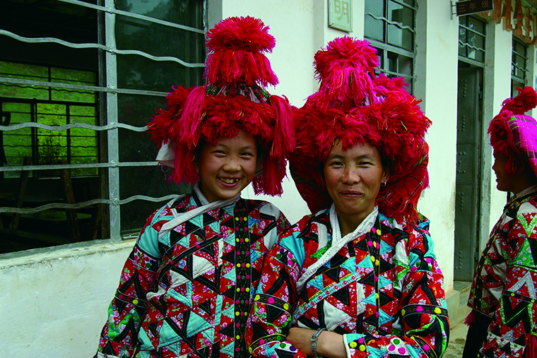 9-7 Traditional Clothing of the Hua Ethnic Minority
Unburdened by the political issues between China and Japan, the mutual trust between the Chinese and Japanese participants in this project has become unshakable. The school was completed in April 2013.
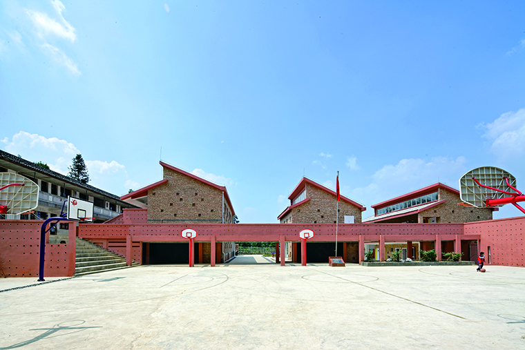 9-8 Matiji Hope Elementary School (2013)
The bridge connecting the buildings is covered by a bougainvillea pergola.
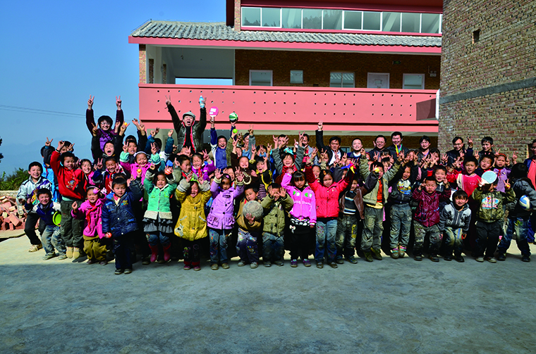 9-9 Children from Matiezhai Hope Elementary School and the Nikken Sekkei [Shanghai] Volunteer Team
Nikken Sekkei Volunteer Division, “Escape Map Project” Website: “Evacuation Topography and Time Map: Escape Map—Supporting Town Planning to Prepare for Earthquakes”
Nikken Sekkei (2012), *NIKKEN JOURNAL 10 2012 Spring*, “Chugoku Project,” Nikken Sekkei
Nikken Sekkei (2013), *NIKKEN JOURNAL 15 2013 Summer*, “School Facilities,” Nikken Sekkei