A landscape-led master plan for an era of coexistence with nature –
The Singapore Rail Corridor
Scroll Down
Greenery and public spaces are becoming increasingly important as a measure against climate change and as infrastructure that enriches urban life. The Rail Corridor, which began in 2015, is a project to regenerate the former site of the former Malayan Railway, which runs north-south through Singapore, into public space. How was this grand national project, spanning a total length of 24 km and an area of approximately 100 hectares, realized? We introduce Nikken Sekkei's landscape-led master plan, which is suitable for the era of coexistence with nature.
CATEGORY
RELATED EXPERTISE
RELATED PROJECTS
Regeneration of a vast public space spanning 24 km and approximately 100 ha
The Rail Corridor is the nickname for the former railway site that was abandoned and returned by Malaysia in 2011. It is a vast space 24 km long and totaling about 100 hectares that runs north to south across Singapore. Examples of utilizing abandoned railway sites include the Promenade Plantée in Paris (1986) and the High Line in New York (2011), but the Rail Corridor is on a scale that is unparalleled. Moreover, since it is not on an elevated track but is located at ground level and directly connected to the town, its regeneration had a huge impact on the citizens, making it a truly major national project.
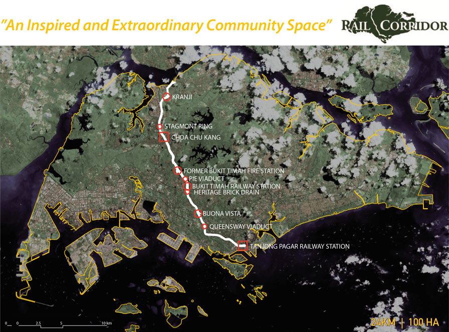 The Rail Corridor that runs through the center of Singapore (the abandoned site of the former Malayan Railway)
Creating a new lifestyle from public spaces
The concept “Stitching the nation with lines of life,” aimed to regenerate the railway that once divided Singapore's territory into east and west as “stitches” connecting communities. The use of “LINES” instead of “LINE” reflects the vision that the countless “lines of life” created by the diverse people who visit and interact here will sew the nation together.
 Depicting various scenes of daily life that will emerge when the Rail Corridor opens up to the surrounding towns.
In developing the proposal, we assembled a cross-disciplinary team that included urban designers and landscape architects from Nikken Sekkei, as well as local landscape firms, engineering firms, and experts from various fields. What the project members valued most was the principle of “landscape first.” True to this motto, we visited the site multiple times, walked along the Rail Corridor, and conducted detailed surveys and analyses repeatedly.
What is a landscape-led master plan?
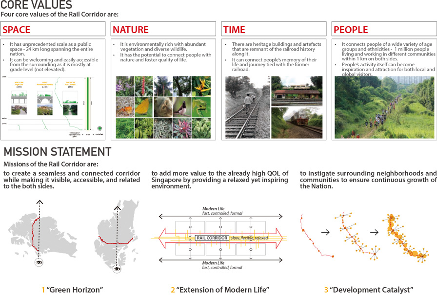 Top: The “four values” of the Rail Corridor; Bottom: The “three goals” of the Rail Corridor
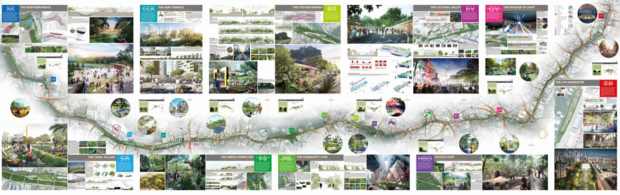
By interpreting the land, understanding its history and context, and deciphering the community, we ultimately gain insight into Singapore as a nation. We then distill the unique character of each area and its value into 10 nodes, integrating them into a cohesive 24-kilometer-long public space. This approach to planning is the “landscape-driven master plan” that Nikken Sekkei envisions.
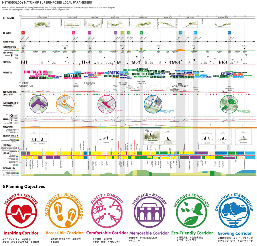 Upper section: A site analysis matrix providing an overview of the characteristics (access, land use, transportation, topography, vegetation, etc.) of the 24-km-long site.
Lower section: Six stories that create diversity in the Rail Corridor.
In 2016, design work for the pilot development zone finally began. Workshops were held for local residents, and interviews were conducted with the Singapore government, citizen groups, and experts, with their feedback incorporated into the master plan. In this way, a new public space was created that is neither purely top-down nor bottom-up, but rather a collaborative effort with citizens.
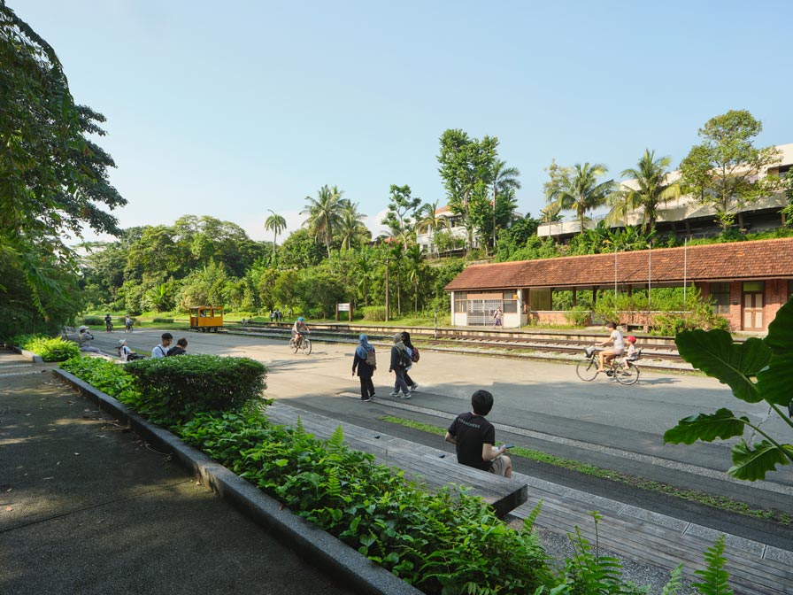 Bukit Timah Railway Station, which was renovated while retaining the existing station building, has become a place of relaxation for local residents.
© Fabian Ong
What is needed is a “long-term perspective” and “cross-boundary awareness.”
Once a negative element that divided Singapore, the Malay Railway has now been transformed into a true public space connecting cities. The bustling nodes serve as catalysts, linking various areas and bridging divisions. In this, we sensed the strength and value of public spaces.
-
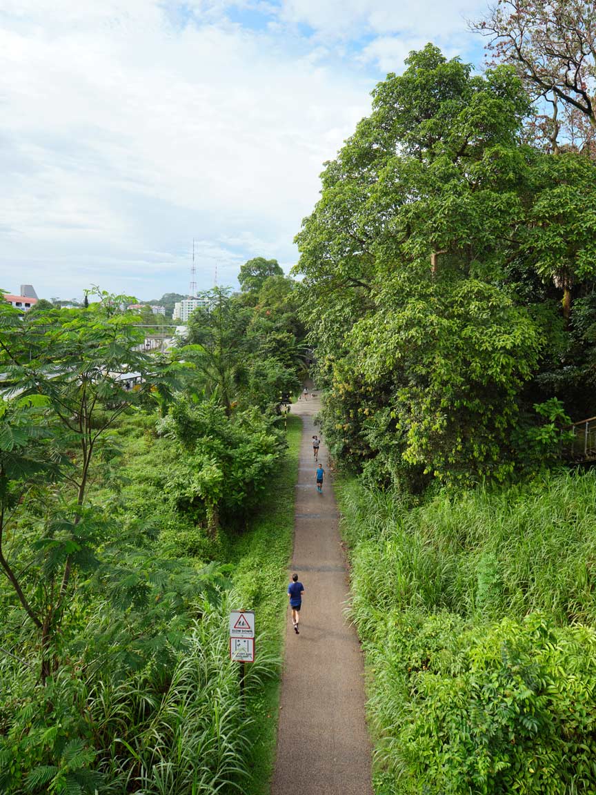 The green-surrounded section is popular with runners.
© Fabian Ong -
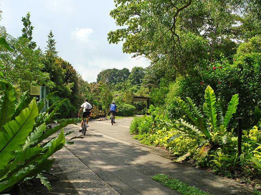
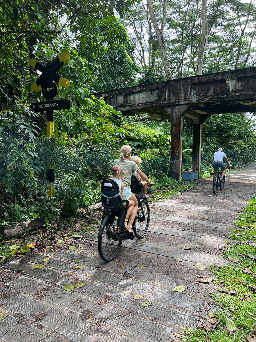 It is also used as a daily route for commuters.
© Nikken Sekkei -
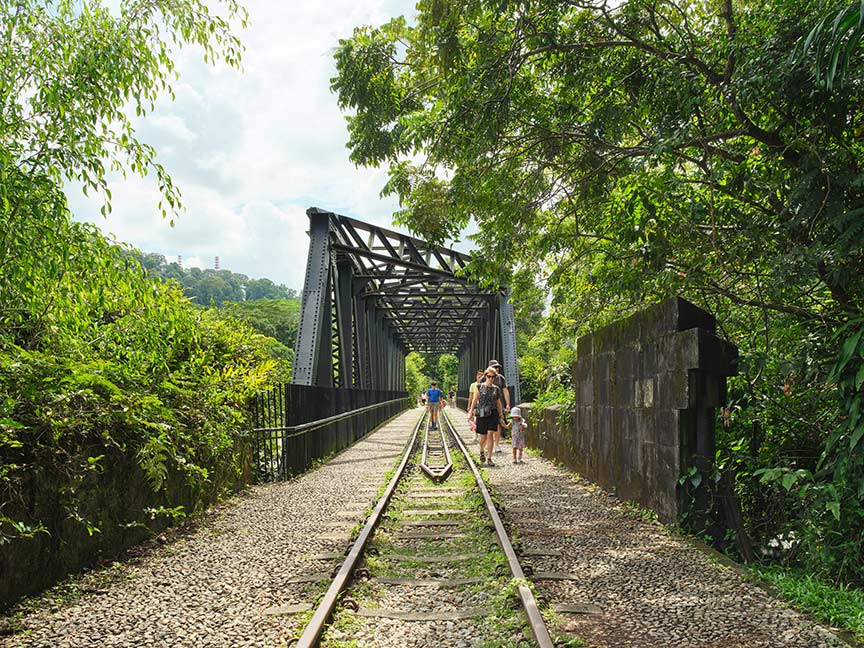 Utilize truss bridges and railroad tracks as historical heritage sites.
© Fabian Ong -
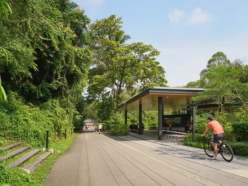 Roofed rest areas are essential in this hot and humid climate.
© Fabian Ong -
 Lush greenery greets visitors at the entrance to Bukit Timah.
© Fabian Ong
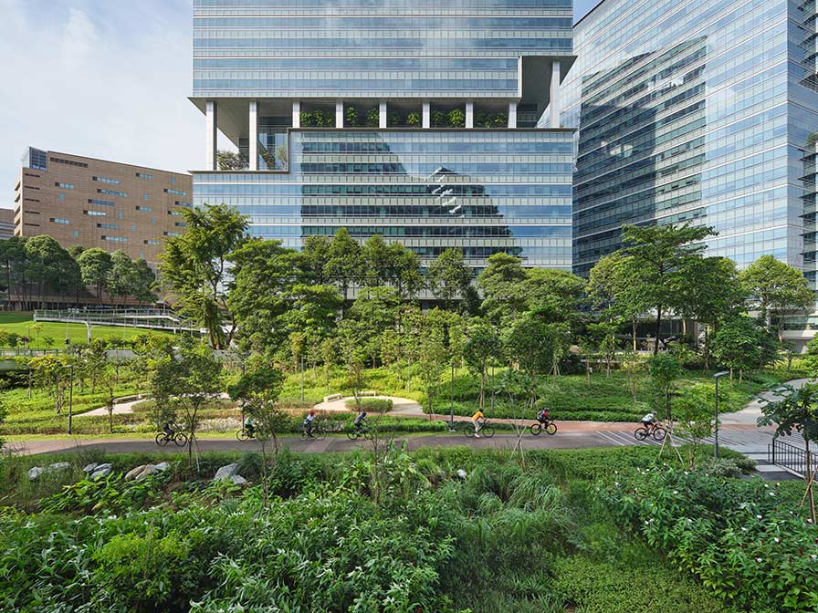 The Rail Corridor, which is a public space improvement project, and the public spaces developed by the private sector have been integrated to create a beautiful and user-friendly space.
© Fabian Ong
Nikken Sekkei will continue to explore new forms of nature-rooted public spaces by leveraging the insights gained from the Rail Corridor project. We also aim to expand this movement through various projects both domestically and internationally.